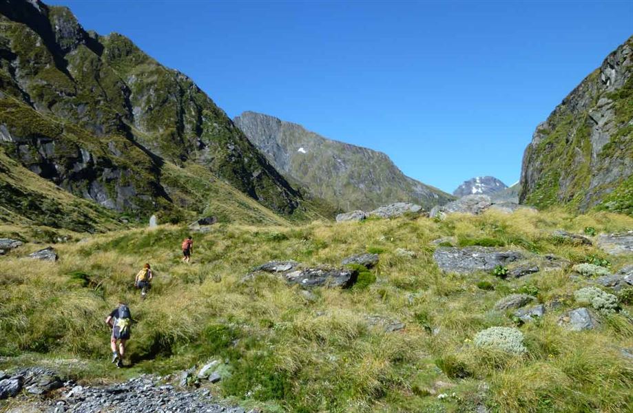
Wilkin Valley tracks
Alerts
Avalanche NZ
Check Avalanche NZ for the full avalanche forecast before you go.
Sorry, we can't show Avalanche NZ forecasts or alerts on this site. Avalanche NZ doesn't permit it.
Check the DOC website for current alerts and conditions before you go. This site gets current alert info from DOC, but is not an official source of information.
These tracks follow the upper reaches of the Wilkin Valley and can be treated as a separate tramping trip or connect with, say, the Gillespie Circuit. It can also lead to a route to the Matukituki Valley.
Elevation
Cover mapped summer 2023/24.
Sampled from the national 8m elevation model. No LiDAR survey covers this route yet.
Description
Wilkin Road to Kerin Forks Hut
Time: 4–5 hr
Distance: 15 km
From Wilkin Road off SH6 make your way down to the Makarora River and cross with care, watching for soft sand. The Wilkin Valley Track is located on the true left of the Wilkin River.
It is rough in places in the lower valley as it undulates through the forest before reaching Dans Flat and continuing up valley on open river flats.
Kerin Forks Hut is located on the true right of the Wilkin, near its confluence with Siberia Stream. Trampers will need to pick a suitable point to cross the Wilkin River to the hut.
Warning: Crossing the Makarora and Wilkin Rivers should only be attempted by parties with river-crossing experience. Be prepared to wait if the rivers are too high to cross.
Kerin Forks Hut to Top Forks Hut
Time: 6 to 8 hr
Distance: 15 km
The track begins behind the Kerin Forks Hut, passing through beech/tawhai forest beside the Wilkin River and over several slips and steep-sided ravines that require care. It emerges at Wonderland flats, a good lunch stop halfway between the two huts.
At the end of Wonderland flats the track re-enters the forest, then climbs and sidles above the river before descending to the Jumboland flats. From here the route is unmarked – follow the river flats to the junction of the north and south branches.
When the river is low, an unmarked river route follows the true right, fording the river several times before reaching flats near the hut. If the river is high, follow track markers leading over a hill.
The Top Forks Hut (600 m above sea level) is above the junction, on the true right of the river’s south branch.
Top Forks Hut to North Branch
Times:
- Lake Diana: 1 hr
- Lake Lucidus: 1 hr 30 min
- Lake Castalia: 3–4 hr
The North Branch is an excellent day trip. The track crosses the South Branch in front of the Top Forks Hut and follows the North Branch. Most of this section requires boulder hopping – slippery if wet – then crosses a small side stream that can be tricky to ford.
The track enters the forest and climbs a predominant spur between the side stream and the North Branch to emerge at a small lake, the Disappearing Tarn. Five minutes further, just south of the track, Lake Diana nestles in sub alpine vegetation. Lake Lucidus, a spectacular moraine lake, is 20 minutes away across the grasslands.
The track to Lake Castalia branches off the Lake Lucidus track just beyond the boardwalk. It crosses the outlet stream, then the North Branch, to climb through alpine vegetation then re-cross the North Branch to a snow grass terrace leading to Lake Castalia’s outlet. Take care scrambling over loose rock in the last 200 m.
Know before you go
Bad weather
The weather can change rapidly in New Zealand. Hypothermia is a real risk even in summer. Be prepared by having warm, waterproof, windproof clothing and the appropriate footwear. Whiteout conditions caused by snow or low cloud may be present. Check the Mount Aspiring National Park weather forecast – NIWA website.
Stay safe when crossing rivers and streams
If you plan to cross unbridged rivers or side streams, know how to cross safely and be prepared for if you cannot cross.
Do not cross if the river or stream is flooded, you cannot find safe entry and exit points or are unsure it’s safe. Turn back or wait for the river to drop. If in doubt, stay out.
NIWA river flow forecasts: View a video of national followed by regional river flows
Be avalanche alert
Avalanches can occur in any season. Any time that snow and steep slopes are combined there is potential for an avalanche. You need to understand the risks before you visit avalanche-prone country.
This area has terrain that can produce avalanches that cross the track, usually from May into November. View avalanche information and the terrain rating for this track.
No visitor centre in Makarora
Contact the Awarua/Haast or Tititea/Mount Aspiring National Park visitor centres instead.
Nearby
Weather
Forecast at the start of the track