Wairepo Kettleholes Track
Alerts
Check the DOC website for current alerts and conditions before you go. This site gets current alert info from DOC, but is not an official source of information.
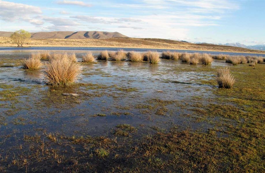
Wairepo Kettleholes provide a feeding area for both native and introduced birds.
Elevation
Cover mapped summer 2023/24.
Description
The initial part of this track is a public access easement along a formed road. Climb over the stile to enter the conservation area.
Head east to find the kettleholes which are down in depressions. These kettleholes provide an important feeding area for a number of key bird species including the endangered kakī/black stilt. Fragmented patches of red tussock are throughout the conservation area, particularly alongside Wairepo Creek.
Mountain biking
It is an easy ride along the formed road to Wairepo Kettleholes Conservation Area. You need to lift your bike over the stile. There is an old farm track that can be ridden along inside the conservation area.
This is a shared-use track. Follow the mountain bikers code: respect others, respect the rules, respect the track.
Getting there
Turn off SH 8 onto Quailburn Road off, 4 km north of Omarama. After the Clay Cliffs turn-off the road changes to a gravel surface. Drive carefully as this road often has mountain bikers on it during summer months.
Weather
Forecast at the start of the track