Te Kuri Farm Walkway
Alerts
Check the DOC website for current alerts and conditions before you go. This site gets current alert info from DOC, but is not an official source of information.
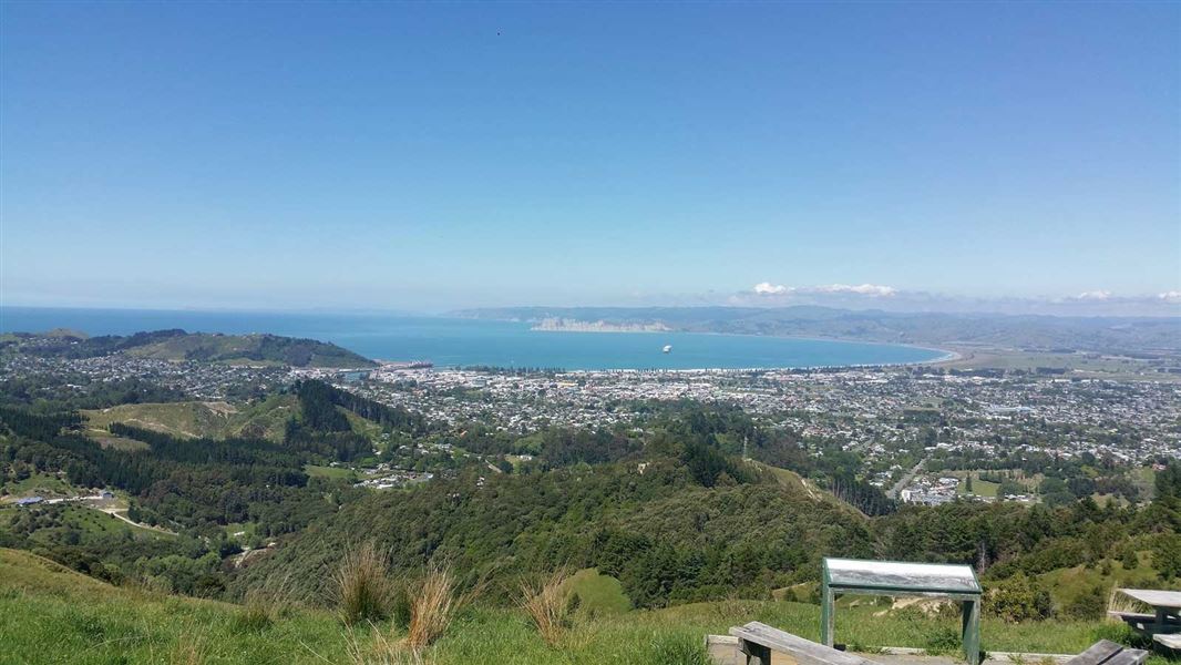
Enjoy panoramic views from various points on this track, as well as from a lookout point at the top (290 m).
Elevation
Cover mapped summer 2023/24.
Description
Te Kuri Farm Walkway is located on a private farm on the northern outskirts of Gisborne. The walkway has a well defined track that is suitable for people with average physical fitness. It is a 2-3 hour loop that can be walked in either direction.
The walkway initially passes through areas of flat farmland before steadily climbing 230 metres to a lookout point (Town Hill, 290 metres). There is a steady climb up to this lookout, and the view it gives of the Poverty Bay flats is well worth the effort. A special feature of the walk is the panoramic views which can be seen from various points along the route.
There is one notable area of remnant, semi-coastal forest of a type once common on the foothills of the Poverty Bay Flats. The bush in the gullies is dominated by puriri, kohekohe and mahoe, while the ridges and slopes are clothed in kanuka, forest and blackwood plantations. Elsewhere radiata pine is the dominant species.
The bush provides a home for a number of forest birds such as tui, kereru (native wood pigeon), owl (ruru), grey warbler (riroriro) and fantails (piwakawaka).
On a clear day from the Town Hill lookout, visitors can see as far south as Mahia Peninsula and as far west as Maungapohatu on the eastern fringes of Te Urewera.
Getting there
Two-wheel drive cars take care of pot holes
Take care driving Shelley Road to access Te Kuri Walkway car park. This road has large deep pot holes that could damage vehicles. Two-wheel drive vehicles may get stuck and need assistance to get out. The last section of the road is gravel.
The walkway is signposted from the Ballance Street/Ormond Road corner of Gisborne City. Visitors can drive straight to the start of the walkway at the end of Shelley Road, where there is a large carpark and a picnic area.
Know before you go
Wear good quality walking shoes or boots.
There is no drinkable water available on the walkway.
No dogs, horses or mountain bikes are allowed on the walkway.
The track crosses private farmland, be aware of stock and leave gates as you find them. You may encounter bulls – walk around them, do not disturb or get close to them.
Pot holes
Take care driving Shelley Road to access Te Kuri Walkway car park. This road has large deep pot holes that could damage vehicles. Two-wheel drive vehicles may get stuck and need assistance to get out. The last section of the road is gravel.
History and culture
In earlier times there was a great deal of Maori settlement on the coast and inland to the hills around the Poverty Bay flats. A number of iwi (tribes) and hapu (sub tribes) are associated with the area, tracing their original settlement back to around the 12th century.
Another period of settlement was initiated following Captain Cook's 1769 landfall in the bay and the city of Gisborne has developed out of this meeting of cultures.
In the 1880's the majority of buildings were in what is now the central business district and along Gladstone Road. There were very few buildings on the northern side of the Taruheru River although Ormond Road was partially formed.
Weather
Forecast at the start of the track