Manganuku Track
Alerts
Check the DOC website for current alerts and conditions before you go. This site gets current alert info from DOC, but is not an official source of information.
This track follows the Manganuku Stream to the Manganuku Hut.
Elevation
Cover mapped summer 2023/24.
Description
From the Historic Howe Truss Bridge take the gentle benched track that runs beside the true right of the Manganuku Stream.
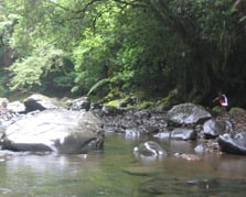
After about an hour you will get to a directional sign, from here head down to the river to a good swimming hole in the Manganuku Stream.
From here you can continue walking upstream in the river for 2 hours approx and you will arrive at the Manganuku Hut. The river exit to the hut is marked with a large orange track marker. There are some deep stream crossings if river levels are high so check before you leave.
Getting there
The track starts beside the Manganuku Campsite, located 47 km from Opotiki, adjacent to SH2 and the Manganuku Bridge.
Nearby
Weather
Forecast at the start of the track