Kapakapanui Track
Alerts
NIWA weather risks
NIWA's Parks Weather site lists daily weather risks for the forecast point below.
Sorry, we can't show NIWA weather or alerts on this site. NIWA doesn't permit paid apps to do this.
Forecast point: Kime Hut (1400m) · 9.2km away
Check the DOC website for current alerts and conditions before you go. This site gets current alert info from DOC, but is not an official source of information.
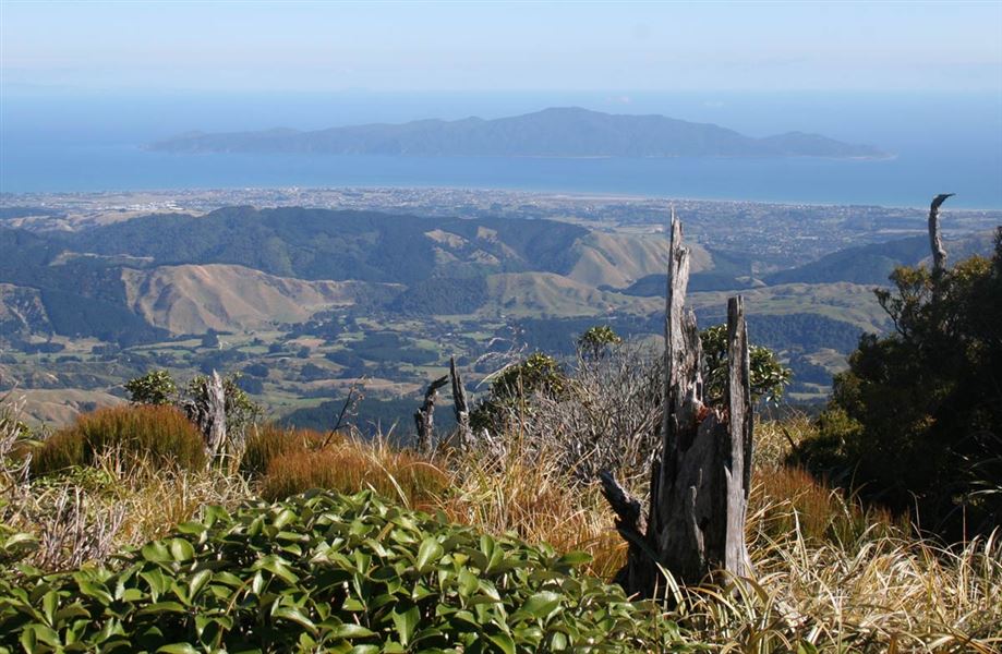
The open summit of Kapakapanui is one of the best viewpoints in the Tararua Range.
Elevation
Cover mapped summer 2023/24.
Description
Kapakapanui is an isolated minor peak of 1102 metres in the southwest corner of the range, dominating the skyline from Paraparaumu and Waikanae.
The open summit of Kapakapanui is one of the best viewpoints in the Tararua Range, revealing not only the full extent of the Southern Crossing, but also the featureless forested maze of the Renata-Maymorn-Akatarawa uplands, as well as the sweep of the Kapiti coastline and the dramatic silhouette of Kapiti Island 22 km to the west. The forest still bears the marks of the devastating 1936 cyclonic storm.
This is a rough, muddy tramping track, with lots of tree roots. It is very slippery in wet weather. The track is very steep and needs good fitness and balance.
The first 20 minutes requires nine unbridged river crossings. Be prepared to get wet feet. Do not attempt to cross the river if it is in flood or if you have any doubt about its safety. Check the weather forecast before you go, we recommend choosing a different track in wet weather or after heavy rain.
Getting there
From Waikanae, follow Reikorangi Road and turn into Ngatiawa Road.
From the Hutt Valley, follow Akatarawa Road and turn into Ngatiawa Road at the junction. Carry on for another 3 - 4 km to the carpark.
Know before you go
The track begins on private property. Park considerately and keep dogs on a lead.
Stay safe when crossing rivers and streams
If you plan to cross unbridged rivers or side streams, know how to cross safely and be prepared for if you cannot cross.
Do not cross if the river or stream is flooded, you cannot find safe entry and exit points or are unsure it’s safe. Turn back or wait for the river to drop. If in doubt, stay out.
NIWA river flow forecasts: View a video of national followed by regional river flows
This is a challenging day hike
It’s a very steep track and parts are rough, muddy and slippery. There are many river crossings. Make sure you have the fitness and the right weather for it.
Pack well, including spare food, emergency equipment, navigation aids and a torch. Leave early and plan extra time in your day, in case it takes longer than expected.
Nearby
Weather
Forecast at the start of the track