Craig Burn Track
Alerts
Check the DOC website for current alerts and conditions before you go. This site gets current alert info from DOC, but is not an official source of information.
Read about the gold mining history of the area at the carpark then walk to a pleasant picnic spot.
Elevation
Cover mapped summer 2023/24.
Sampled from the national 8m elevation model. No LiDAR survey covers this route yet.
Description
Craig Burn carpark to Craig Burn: 4 km return
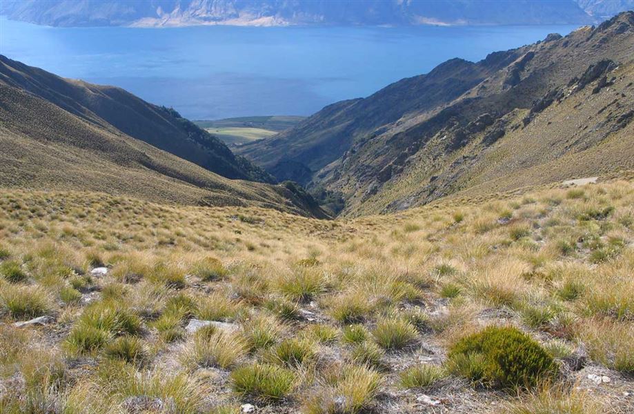
This formed walking track leaves the carpark and travels for 2 km to the lower Craig Burn, a pleasant place to have a picnic. Return to the carpark the same way.
The end of the track meets the Matatiaho Conservation Area boundary. There are no formed tracks above this point until you reach the ridgeline - access is via scrubby, steep, and rocky terrain.
Exit from the Conservation Area is either returning the same way or via the Glen Dene Ridgeline Track to Stewart Creek carpark – from the Conservation area boundary this exit is 15 km, 5-7 hours one way.
Getting there
Craig Burn carpark is just off the Lake Hawea section of SH6, 20 minutes’ drive north of Wanaka Township.
Know before you go
Bad weather
The weather can change rapidly in New Zealand. Hypothermia is a real risk even in summer. Be prepared by having warm, waterproof, windproof clothing and the appropriate footwear. Whiteout conditions caused by snow or low cloud may be present. Check the Mount Aspiring National Park weather forecast – NIWA website.
Be avalanche alert
Avalanches can occur in any season. Any time that snow and steep slopes are combined there is potential for an avalanche. You need to understand the risks before you visit avalanche-prone country.
This area has terrain that can produce avalanches that cross the track, usually from May into November. View avalanche information and the terrain rating for this track.
Private property and permissions
This track crosses private land. There is no camping until the conservation area boundary.
Respect the landowner's livestock and property:
- Stay on the marked track until you reach the conservation land
- Leave gates as you find them
- Use stiles where provided
- Keep your distance from livestock.
Dogs
You need permission from the Makarora River Ranch to take your dog into Hāwea Conservation Park using Boundary Creek Track. Email makaroraranch@gmail.com at least 24 hours in advance of your visit to request permission. You must provide a valid worming certificate to ensure your dog is free from hydatids and sheep measles.
- There is a safari hunting operation on the neighbouring station, give way to game animals, especially during the March to May roar.
- Firearms are not permitted in the Craig Burn.
- Hunting is permitted in the Matatiaho Conservation Area by restricted permit only. See the hunting area page for more information. This is a popular hunting area, it is recommended that you wear visibly bright clothing if planning to tramp in the conservation area.
- Dogs are not permitted in the Craig Burn but are permitted in the Matatiaho Conservation Area.
History and culture
Long Valley gold
Matatiaho Conservation Area includes the lower reaches of the Long Valley goldfield, one of the few gold mines recorded around Lake Hāwea.
The rush to Long Valley began when a few men struck gold 6 km up the valley. By July 1880 there were 60 men on the diggings, increasing quickly to 200. Early miners scoured the creek banks for gold as they made their way from here up to Mount Burke and Craig Burn creeks, seeking the source of the gold. But as the gold finds dried up, so did miners’ enthusiasm. By winter 1881, only two remained.
Little remains of this once-active goldfield. Although it was short lived, the Long Valley goldfield gave birth to a town further up the Craig Burn. At one stage this settlement boasted three stores and two butcheries.
You can view an interpretation panel at Craig Burn Carpark.
Weather
Forecast at the start of the track